Twelve centuries, on one page, with the source beside it
From the Caquetío to the climate case. Neither an anniversary story nor an indictment: a timeline stating, moment by moment, what is established, who says so and what of it is still visible today.
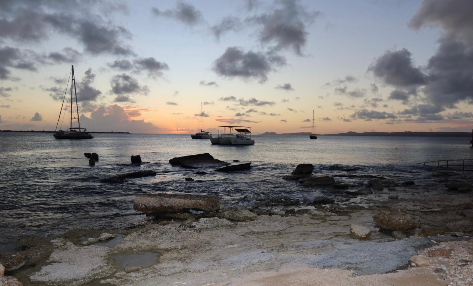
Caquetío
until 1499well over a thousand years4 momentenAn Arawak-speaking people from the mainland, with villages on the leeward side and drawings in the caves.
Finds of tools and pottery point to a human presence well before the time of the later villages. Who came here then, and whether they stayed, is unknown.
An Arawak-speaking people from what is now Venezuela cross over and live on the sheltered west side. They live on fish, maize and cassava, and sail back and forth to the mainland.
Figures drawn in red and black on limestone overhangs, still visible at Onima today. What they mean we do not know, and that is also what it says here.
Middens along the coast contain remains of parrotfish, shellfish and sea turtle. The reef was food before it became a sight.
Spanish period
1499 – 1636137 years5 momentenBonaire is declared a “useless island”, its people deported, the land turned into a ranch.
Alonso de Ojeda sails past the islands; Amerigo Vespucci is part of the fleet. There is no colonisation yet, but there are claims.
The Spanish Crown considers the islands worthless: no gold, no fresh water. The indigenous population is deported to Hispaniola to work in the mines there. The island is left almost empty.
Juan de Ampíes has livestock shipped in. Goats, sheep, pigs and donkeys begin to change the landscape; dividivi and aloe come later as cash crops.
Free-roaming livestock eat the young growth. The forest described in the early sources gives way to the cactus landscape that now defines the image of Bonaire.
Dutch fleets fetch salt from Punta de Araya on the mainland. When Spain blocks that supply, the islands and their pans are suddenly worth the trouble.
WIC and salt
1636 – 1816180 years9 momentenThe company owns the whole island: land, livestock, pans and people. Salt is the product.
Two years after Curaçao, the Dutch West India Company occupies Bonaire. Not to live there, but to take salt, wood and livestock. The whole island becomes company property.
Land, livestock and pans remain the property of the company; private plantations like those on Curaçao barely appear. Whoever works here works for the state in the form of a business.
At the Kralendijk anchorage a bastion goes up against privateers and competitors. It still stands, with a twentieth-century lighthouse beside it.
The settlement is built in an inland valley, invisible from the coast and so safer from privateers. Rincon dates back to around 1527 and is the oldest village on the island.
Enslaved Africans and so-called government slaves rake salt in shallow water, in full sun, without protection. The salt goes to Europe to preserve fish and meat.
On the neighbouring island, well over a thousand enslaved people rise up under the leadership of Tula. The revolt is harshly put down, but it changes the conversation about slavery across the whole colony.
Bonaire and Curaçao come under British rule. Three years later Batavian authority returns; in 1807 the British come again. Short overviews usually leave out that first occupation.
During the Napoleonic Wars the British take over the island for the second time, now until 1816. They sell off land and livestock and leave behind records that historians use today.
The island returns to the Netherlands. The pans are brought back into government hands and production is stepped up.
Pans and forced labour
1816 – 186347 years7 momentenThe period that has left the most still standing: obelisks, huts, and the walk to Rincon.
The enslaved population lives in Rincon. The walk to the pans in the south takes six to seven hours; only Sunday is spent at home.
Production is divided into four pans, named after the colours of the flag and the royal house: white, blue, orange and red.
Stone obelisks in white, blue, orange and red go up by the four pans. A flag in the same colour told the crew at which pan to load. Sources disagree on the year of construction: both 1837 and 1838 appear.
Huts of rubble stone, one and a half by two metres and barely two metres high, with a doorway you cannot walk through upright. Two to six men per hut. At Witte Pan there is one larger house: that of the bomba, the overseer.
Some of the people are moved to Tera Kora, closer to the pans. The neighbourhood now lies behind the airport and in the sources of the time is called the new world.
That year’s records list 363 men in salt production. Blindness caused by sunlight reflecting off the salt crystals recurs in the documents as an occupational disease.
Slavery is abolished in the Dutch colonies, thirteen years after the huts were built. Without coercion, salt production turns out to be unprofitable; those who are free go to work elsewhere.
After abolition
1863 – 195491 years8 momentenSalt stops paying, men leave for Cuba and Venezuela, and the war passes through.
Formally free, but obliged to do wage labour under supervision: only in 1873 does that obligation lapse. In collective memory 1863 is the year; in practice it was 1873.
The government sells the salt pans. Production shrinks to a scale that paid labour can sustain, and that is not much.
Without salt the island lives on aloe sap, dividivi bark for the leather industry, and charcoal. All three take more out of the dry land than it can replenish.
Men leave for the cane fields of Cuba and later for the refineries of Curaçao and Aruba. The money they send home keeps the island going; the families stay in Rincon and Antriol.
Curaçao gets a refinery in 1918, Aruba in 1929. A large share of Bonaire’s men work there; the island becomes a place of women, children and older people living on remittances.
After the German invasion, German and Austrian nationals from across the Caribbean are interned on Bonaire, among them Jewish refugees. The camp exists until 1947; a hotel later stands on the site.
American troops protect the oil route and build a runway near Kralendijk. That runway is the basis of today’s airport, and so of the tourism that comes later.
Photos from this year show paid contract workers at the salt. The work is the same as a century earlier; the relationship is not.
The Antilles and the sea
1954 – 201056 years25 momentenSelf-government, dive tourism, and a marine park that surrounds the whole island.
A beach hotel opens on the site of the internment camp. It marks the start of tourism as an industry, and of the question of who owns the coast.
With the Charter for the Kingdom, Bonaire becomes an island territory within the Netherlands Antilles, with Willemstad as the seat of government. From now on much goes through Curaçao.
A non-profit foundation takes on the management of the nature areas, on behalf of the government and without structural funding. That arrangement explains to this day why there is a Nature Tag.
The American Don Stewart is stranded on the island and stays. He lays the first moorings, names dive sites and argues for a ban on anchoring and the coral trade; many sites still carry his names.
Above the bay at 1000 Steps, transmitter masts go up that reach the Caribbean and South America. To this day they are the landmark of that coast.
Tera di Solo y suave biento, written by Hubert Booi, becomes the island’s anthem. In Papiamentu, not in Dutch.
A former plantation in the north-west becomes the first nature reserve in the Netherlands Antilles. Slagbaai is added later; together well over 5,600 hectares.
A Dutch salt company builds new dykes and evaporation ponds, with a loading pier out into the sea. Salt is an export again, now with machines and forty men.
Bonaire bans spearfishing, years before it became common elsewhere. It is the first in a series of measures in which the sea is seen as a place to visit rather than a stock to draw on.
Collecting and selling coral and shells is banned. Dive schools adopt the rule in their briefing, and that briefing still exists.
A transshipment terminal for crude oil is built at Goto. For forty years it brings work and risk; after 2015 the throughput stops and the tanks stay put.
The first dive resort with its own tank-filling station opens. Shore diving, fixed moorings and yellow stones along the road make Bonaire the place where you step onto the reef without a boat.
The water around the whole island and around Klein Bonaire becomes a protected area, from the high-water mark to sixty metres deep. Touching, taking and anchoring are banned from now on.
Windsurfers discover the shallow bay on the east side. World championships follow; the seagrass and mangrove beneath are only recognised as vulnerable much later.
A cargo ship detained in Kralendijk with marijuana in a false wall, unseaworthy and claimed by no one, goes to the bottom on a sand strip between two reefs. Now the island’s best-known wreck dive.
Hilma HookerA public competition produces no convincing winner; the chair of the flag committee combines elements into a single design. Yellow, white and blue on the diagonal, with a red six-pointed star in a black compass ring. Twenty-nine years before Bonaire joins the Netherlands directly, the island has its own symbol.
The coat of arms with ship’s wheel, compass ring and star is adopted: the same symbolism as the flag, steadfastness and seafaring.
Aruba gains status aparte and leaves the Antilles. The question of what the small islands want — together, separately, or directly with the Netherlands — stays on the table for twenty years after that.
A dedicated foundation starts counting nests and tracking animals. As a result there is now a thirty-year record, exactly where this kind of data is usually missing.
The feral donkeys, descendants of the pack animals of the salt era, are taken into a fenced area. It partly solves both a traffic problem and a vegetation problem.
Salt production passes into the hands of a Canadian multinational. The salt goes mainly to the chemical industry; the pier where it is loaded is a dive site.
Salt PierA late hurricane moves from west to east and damages precisely the sheltered side. Shallow coral near Kralendijk disappears in days; recovery takes years.
A majority chooses a direct link with the Netherlands instead of continuing the Antilles. It takes another six years before that is settled constitutionally.
Heavy swell from the west wrecks the shallow reef at several spots along the leeward side. It is the second proof within ten years that the sheltered coast is not untouchable.
The invasive lionfish reaches Bonaire. A reporting system follows, along with a hunting permit for certified divers; eradication is no longer the goal, control is.
Public body
2010 – present16 years10 momentenThe Netherlands closer than ever, with the dollar, growth and the state of the reef at stake.
The Netherlands Antilles are dissolved. Bonaire becomes not a municipality but a public body: Dutch legislation, its own executive council, and an island council with limited powers.
A warm autumn bleaches coral along the whole west coast. It is the first time this is systematically recorded on Bonaire, and the baseline for everything that follows.
From 1 January the island pays in US dollars. That is why prices on this site are in dollars, even when the law comes from The Hague.
Tree structures with fragments of staghorn and elkhorn coral are used to grow coral, which is then replanted on bare patches. The nurseries can be seen at several dive sites.
The position of Papiamentu in schools and government is formally laid down. The language spoken at the dive site is now also in the law.
Borders close, flights stop, dive centres shut. For the first time it is measurable how the reef behaves without divers: the answer is subtler than either camp hoped.
The distinction between divers and other water sports disappears: everyone pays $ 40 per calendar year. The plastic tag gives way to a QR code in your name.
Two consecutive warm seasons lead to the most severe bleaching recorded on the reef. Which species survived and where recovery is visible, we track site by site.
Residents of Bonaire, backed by an environmental organisation, go to court to force the Netherlands to protect the island. The case is ongoing.
In fifteen years the population grows by more than three quarters, faster than the water supply, the roads and the housing. It is the background to almost every political debate on the island.
Four steps, and the labour that went into them
Seawater flows through sluices into the shallow pans, to a depth of a few decimetres.
Sun and trade wind do the work. The water is moved from pan to pan and grows ever saltier; algae and brine shrimp turn it pink.
In the last pan the salt forms a crust. In the past it was broken up with rakes and wooden shovels, in the water, barefoot.
The salt is scooped up, washed and piled into mountains. Once taken by sloop to the roadstead, now by conveyor belt to the pier.
The four pans are named after the colours of the Dutch flag plus the orange of the royal house. Each pan has an obelisk in the same colour: the beacon the sloops steered towards from the roadstead.
Eight regimes, one island
Who held power can still be read along the coast: in the pans, the obelisks and the names. The bar is to scale from 1499; the centuries before that are shortened, otherwise the rest would not fit.
No flag and no border: kinship and trade with the mainland.
A claim without colonisation. The island is declared “useless” and emptied.
Orange, white and blue. The island is the business premises of a company; salt is the product.
French tides in Europe, administrative unrest in the colony.
Three years of British authority over Bonaire and Curaçao, often skipped in short overviews.
Batavian rule returns, until the British come for the second time.
Nine years of British administration — and with it, usable archive records.
The red, white and blue tricolour. Salt, forced labour, and after 1863 depopulation.
Self-government via Willemstad. From 1981 the island’s own flag flies alongside.
Public body: Dutch law, its own flag, dollars in the till.
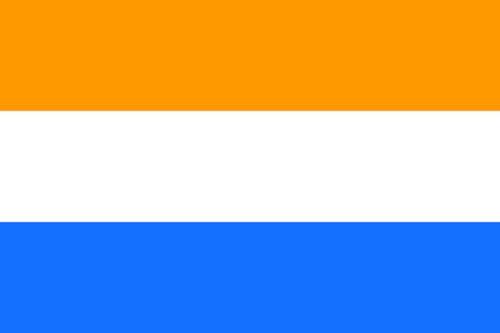
Orange, white and blue. The flag under which the Dutch West India Company took the island and had the pans laid out.
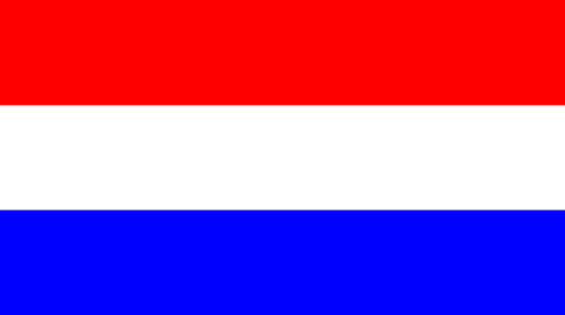
Red, white and blue — and the orange of the royal house. The four salt pans were named after exactly these colours.
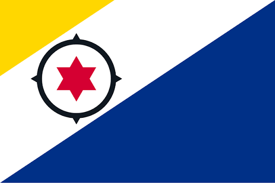
Yellow, white and blue on the diagonal from bottom left to top right, with a red six-pointed star in a black compass ring.
What the island's own flag shows
11 December 1981, by island ordinance. Other overviews give 15 December.
A public competition produced no convincing winner. The chair of the flag committee combined elements from several entries, following guidelines from flag expert Whitney Smith. Ratio 2:3, the same as the Dutch flag.
The sun and the island’s flowers, with the kibrahacha, which bursts into bloom all at once, once a year.
Peace. In some readings also the salt mountains in the south.
The sea, and a thought for the Bonairians who died at sea in wartime.
The reputation of Bonairians as sailors and fishermen: steadfastness, and ties in every direction.
The six original neighbourhoods — Playa, Nikiboko, Tera Korá, Antriol, Nòrt Saliña and Rincon. The red stands for blood and the strength to survive.
Coat of arms since 26 December 1986, with ship’s wheel, compass ring and star. Anthem Tera di Solo y suave biento since 1964, in Papiamentu.
Why did the colonial government build stone huts in 1850, thirteen years before abolition?
A practical measure: housing people closer to the pans did away with the daily six-to-seven-hour walk to Rincon and raised production. Not compassion, but efficiency.
Propaganda. The huts were there to show the outside world that the Netherlands took good care of its slaves, at a time when pressure on the system was already high. Anyone who presents them as homes repeats that message.
We put both readings on the page, with the name of whoever holds them. What is established is the size of the huts, the year they were built and the number of people per hut; why they were built is interpretation, not fact.
From three thousand to over twenty-four thousand
Collects and publishes the island’s history and challenges the smoothed-over version of the salt era. In 2023 he explained the huts to the royal party.
His revolt on the neighbouring island is the benchmark for resistance across the whole colony, and since 2010 a national day of remembrance on Curaçao.
Came by boat, stayed, and turned shore diving into an industry. Argued for moorings instead of anchors and for a ban on the coral trade before there was a park.
Had livestock brought to the islands after the population had been deported. The landscape we now see as typically Bonaire begins with that decision.
The meaning of the inscriptions at Onima and Spelonk is unknown. Any explanation you read on a sign is an interpretation.
Annual figures vary widely between sources, partly because people were moved between the islands. We only give figures that come from a single set of records, such as the 363 men of 1853.
There are different accounts of the make-up of the group of internees. We stick to what is in the camp records and say where they are silent.
Little is documented of the buildings in Rincon from the salt era. A survey of the buildings is on our own to-do list, not in a source.